


")

 |
Stage 2019/14 [A076] | ||
|
Delta Junction - Fielding Lake (Richardson Highway) |
|||
| 67 mi / 108 km | |||
| 1200 Hm (garmin edge 1000) | |||
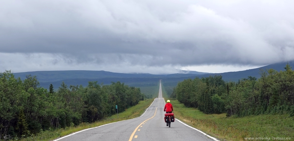
Cycling Whitehorse, Yukon to Anchorage, Alaska via Dawson City.Stage from Delta Junction to Fielding Lakes following the Richardson Highway.One of the most epic cycling routes of the world. |
 Before leaving Delta Junction southbound, we go to the coffee corner of the supermarket for breakfast. Over there we were welcomed by the employee we talked to yesterday with the words "You are late!". After breakfast we say goodbye as if we had known each other for a long time. That's how things are done here. Even the tattooed truck that had breakfast at the next table did not leave without saying goodbye and announcing he would be back in 4 days time. Heavily loaded with the proviant we bought yesterday (we do have 31 bread rolls on board now) we cycle south on Richardson Highway. The first few kilometers outside Delta Junction we drive past the facilities of the largest employer in this region: the site belongs to Fort Greely, a base operated by the US Army, on which a missile defense system is installed. Here, ground-based midcourse defense system (GMD) interceptor missiles are stored in large silos, with which ICBMs should / could / would be intercepted. |
 Richardson Highway runs from Valdez on the Prince William Sound via Delta Junction to Fairbanks and was once the most important road of Alaska. The branch to Canada via the Alaska Highway was built much later. |
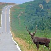
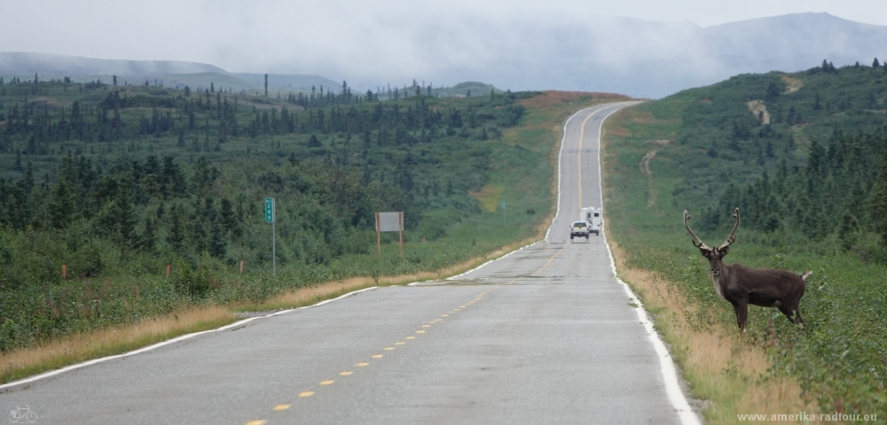 On the highway we could observe the behaviour of caribous: some carefully approach the road to look left and right before crossing the highway to see if everything is clear. Other animals are not that careful and just run straight forward. |
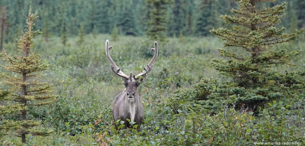 As far as I know do also female animals have antlers, so for me it is impossible to determine the sex of the animals from a greater distance. Bulls weigh up to 400lb / 180kg on average, individual animals up to 660lb / 300kg. You don't want to stand in their way. |
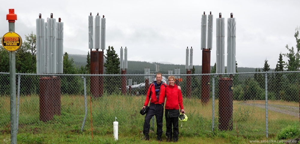 Round about 7mi / 12 km south of Delta Junction we pass a pumping station of the Trans-Alaska Pipeline. Here we have a great view of the pipeline structure, which runs above ground and largely follows the route of the Richardson Highway. The pipeline runs from Prudhoe Bay 800mi / 1,287 km to the loading port in Valdez. At first glance, an oil pipeline is nothing more than a pipe through which oil is pumped. Sounds easy. However, the oil must be heated to keep it flowing. That makes it a bit more difficult because the pipe has to be thermally insulated by a jacket. It becomes even difficult when the pipeline runs over permafrost soil: when the warm crude oil to be transported conducts its heat via the pipe to the steel supports, the frozen soil under the supporting structure thaws and the entire structure is doomed to sink into the mud. To prevent this from happening, the steel supports are filled with a liquid medium building a system called heatpipes. The principle is simple: the warm liquid rises in the steel support, cold liquid settles on the floor of the pipe. Heat exchangers are attached at the top of the heat pipes, which transfer the heat to the cold outside air. The heat brought into the ground by the heated crude oil is transported away from the soil and dissipated into the ambient air. It is probably only thanks to the heat pipes that we don't sink into the mud in today's rainy weather. |
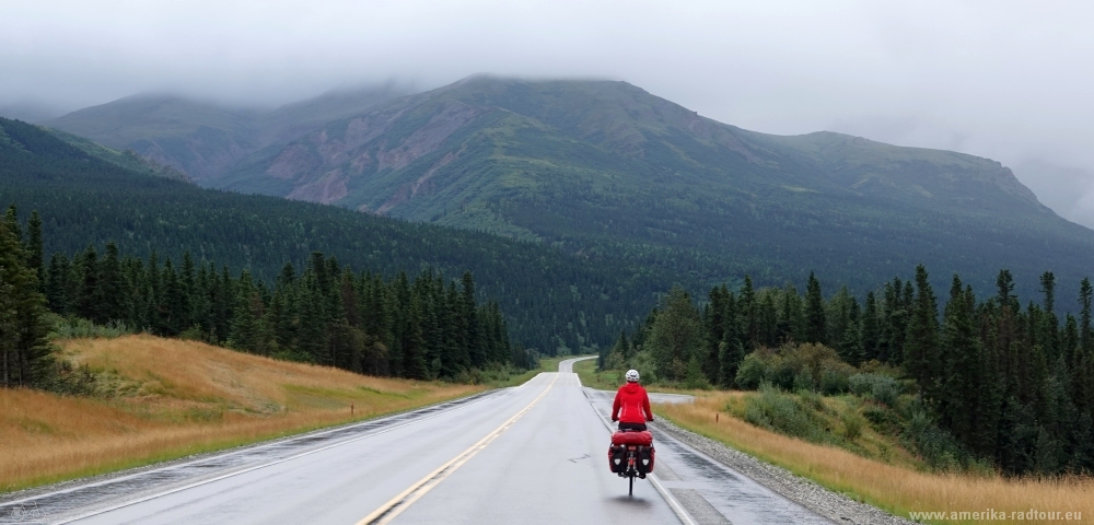 We continue to cycle south on the Richardson Highway. The highway is slowly gaining height. After all, by crossing the Alaska Chain we do cross the continental divide between the Bering Sea in the north and the Gulf of Alaska in the south. |
 On the way we stop at a rest area from which the animals of the Delta Bison herd can be seen. At least when there is good weather. The weather today is cold, wet and windy, so I fully understand that the herd does not show up. Bisons have always lived in this area, but they were hunted so heavily by humans that they were soon threatened with extinction. In 1920, 23 bison from Montana were brought to the Delta River area and resettled there. The animals got along quite well in their new habitat and continue to reproduce so vigorously to this day that the population is kept at a size of around 1000 animals through the sale of hunting licenses. Not a single one could be seen today, but it's no weather to go out either. |
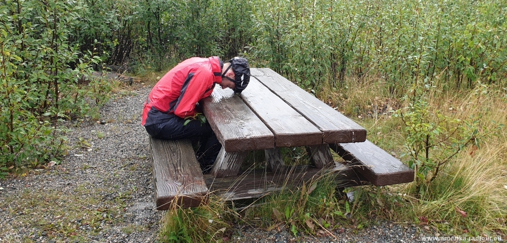
 Over the day the Richardson Highway decides to show a different face: over time the rain subsides, but it remains windy. |
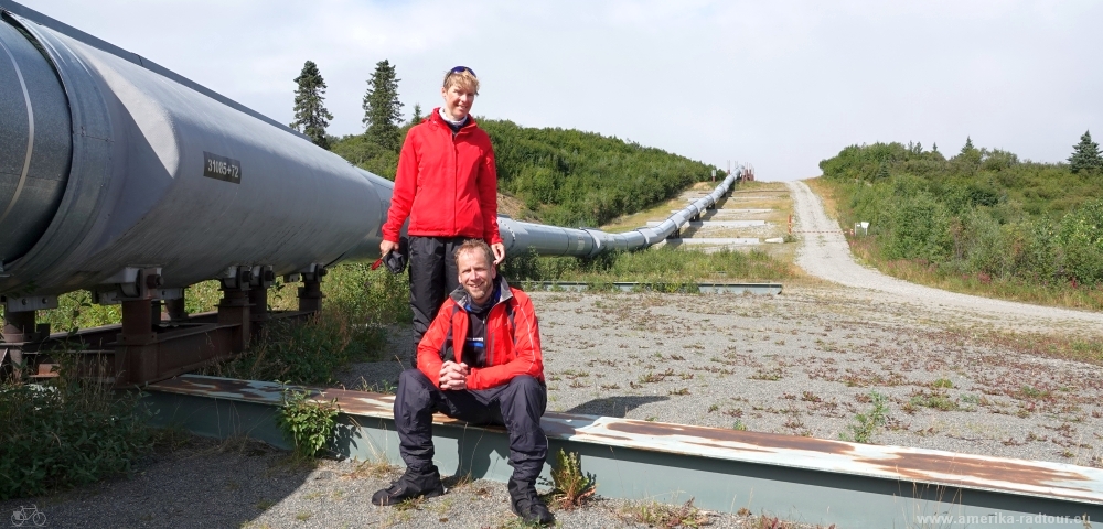 About 50mi / 80km south of Delta Junction there is another opportunity to take a closer look at the Trans-Alaska Pipeline. The pipeline crosses several earthquake-prone regions on its way across Alaska, in particular the Denali Fault, which is regarded to be active. To prevent damage to the pipeline in the event of an earthquake, the pipeline system has a floating connection to the ground using horizontal steel girders up to 60ft / 18m long. They are supported by Teflon bearings, which should enable the pipeline to slide smoothly in the event of an earthquake. In case of an earthquake the ground practically sways back and forth under the pipeline without any harm for the pipes. The construction is designed for an earthquake with a magnitude of 8.5 on the Richter scale. The structure was involuntarily subjected to a stress test on November 3, 2002 when a 7.9 earthquake struck in the immediate vicinity of the pipeline. The construction has moved as calculated on the horizontal beam and is now off-center on the girders. So far so good. The question that occurs to me is why untill today no one has bothered to reposition the Trans-Alaska Pipeline in the center of the steel girders. |
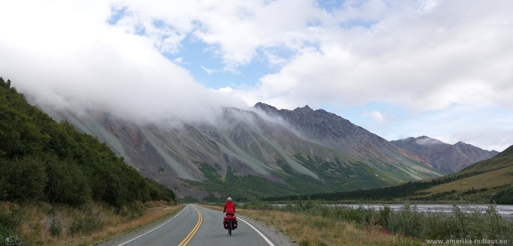 As we continue to follow the valley, we (the Richardson Highway, the pipeline and the two of us) slowly gain altitude. The wind is driving clouds over the mountains of the Alaska Range and creating an uncomfortable dark atmosphere. If it's about to start snowing right now, I wouldn´t be surprised. |
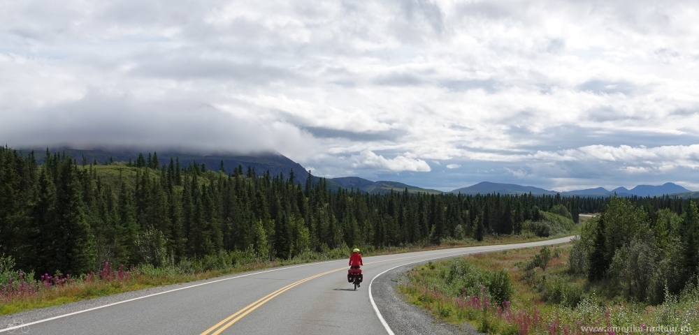
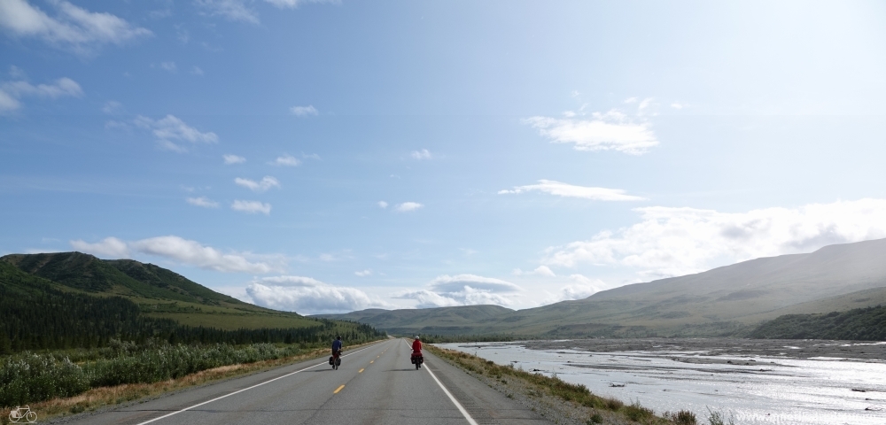 In the further course the valley opens again, the mountains to the left and right of the highway get lower. Shortly before we reach the highest point of the Richardson Highway at Isabel Pass, we turn right, cross the pipeline and drive to our destination for today, Fielding Lake. |
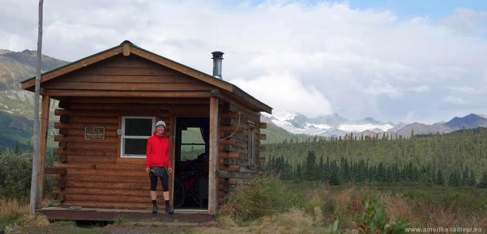 Fielding Lake is about 3000ft / 900m above sea level and has a frozen surface from autumn to spring. The ice floes sometimes last until the end of July. Several glaciers belong to the panorama, the mountains in the background are over 6500ft / 2000m high. The wind is uncomfortably strong and it gets even more uncomfortably cold in the early afternoon. We reserved this cabin in advance at Alaska State Parks and are happy to be able to close the door behind us and leave the cold wind outside. In the evening it gets icy cold here, and the wind doesn't stop at night either. The outhouse is only 50m away, but given the climatic conditions this can be a long way. |