


")

 |
Stage 2022/15 [SA015] | ||
|
Angastaco - San Carlos |
|||
| 51 km / 32 mi | |||
| 500 Hm (garmin edge 1000) max. Altitude: 1960m | |||
Ruta 40 by bicycle: From Angastaco through the Quebrada de las Flechas to San Carlos. |
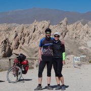
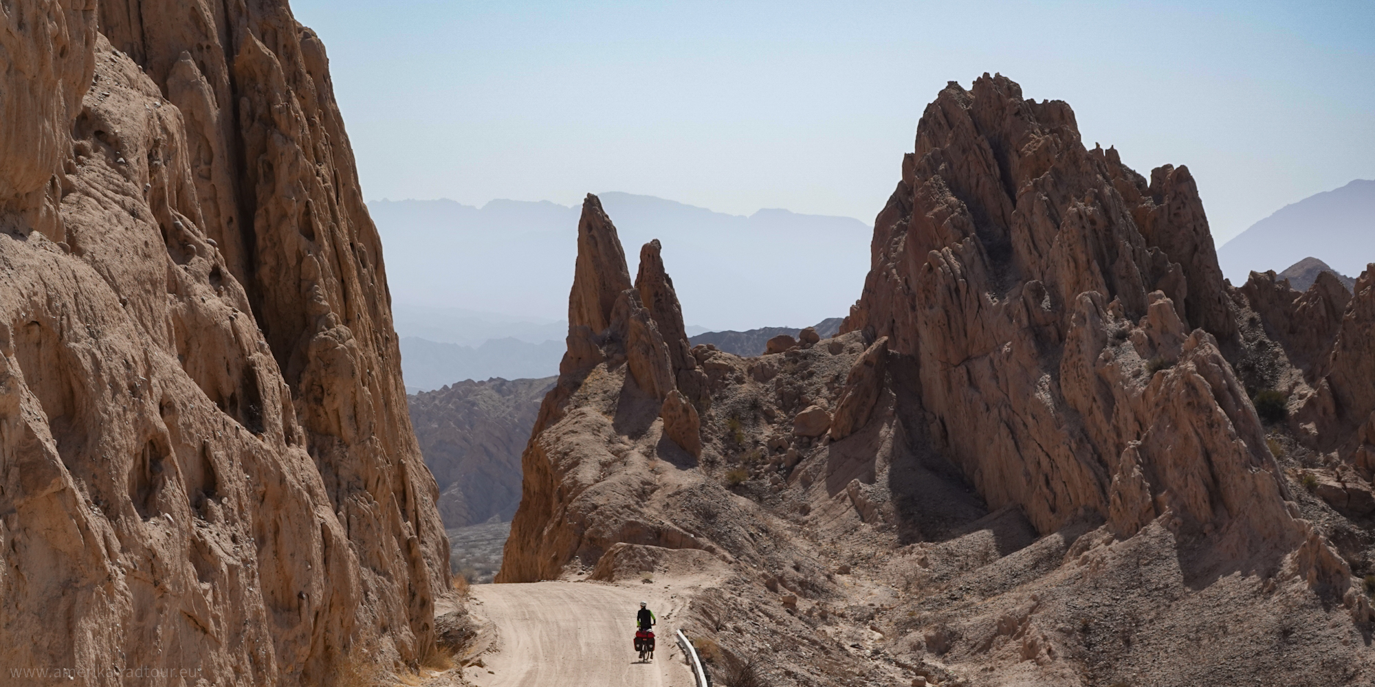
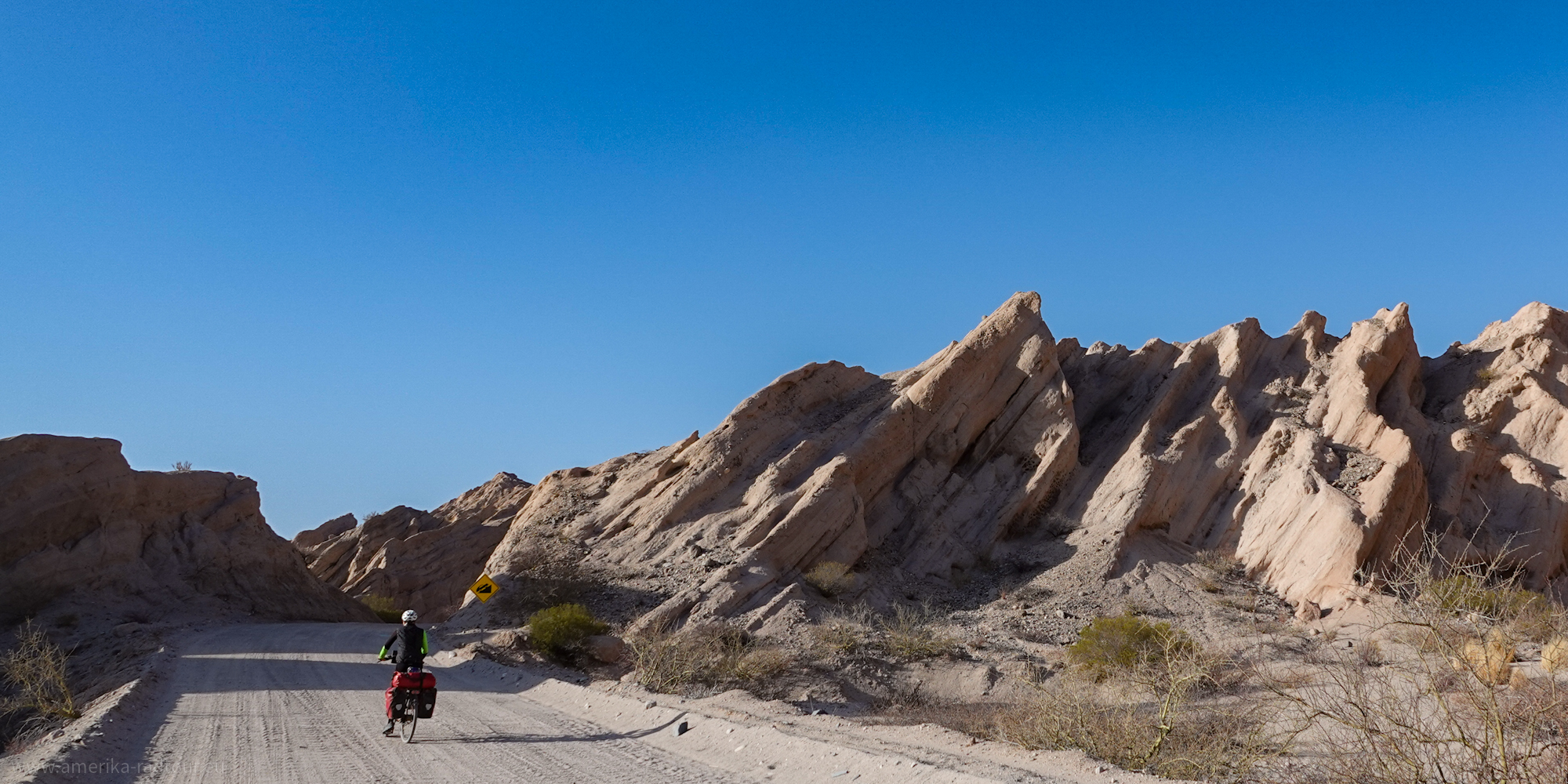 Yesterday was challenging, exhausting and tough. Today is completely different: it is challenging, exhausting and tough and spectacular. And that is the case right from the start, because less than 2 kilometers / 1 mile east of Angastaco we enter the Quebrada de la Flechas, a particularly spectacular section of Ruta 40. We have barely left Angastaco when steep rock formations tower up next to us on both sides of the gravel road. The upper ends of the towering rocks point like arrows into the sky, which has led to the name "Arrow Canyon". Yesterday was challenging, exhausting and tough. Today is completely different: it is challenging, exhausting and tough and spectacular. And that is the case right from the start, because less than 2 kilometers / 1 mile east of Angastaco we enter the Quebrada de la Flechas, a particularly spectacular section of Ruta 40. We have barely left Angastaco when steep rock formations tower up next to us on both sides of the gravel road. The upper ends of the towering rocks point like arrows into the sky, which has led to the name "Arrow Canyon". |
 Coming from the north or from Angastaco, there are two steep climbs with gradients well over 5%, which are not easy to climb due to the loose gravel road surface. If you come to a stop here with your bikcycle, it will be difficult to get going again on this surface. Coming from the north or from Angastaco, there are two steep climbs with gradients well over 5%, which are not easy to climb due to the loose gravel road surface. If you come to a stop here with your bikcycle, it will be difficult to get going again on this surface. |
 Behind the first climb, a breathtaking rocky backdrop awaits you: the rocks tower up steeply next to Ruta 40, which winds through the gorge. Things get really spectacular on the second climb, . . . Behind the first climb, a breathtaking rocky backdrop awaits you: the rocks tower up steeply next to Ruta 40, which winds through the gorge. Things get really spectacular on the second climb, . . . |
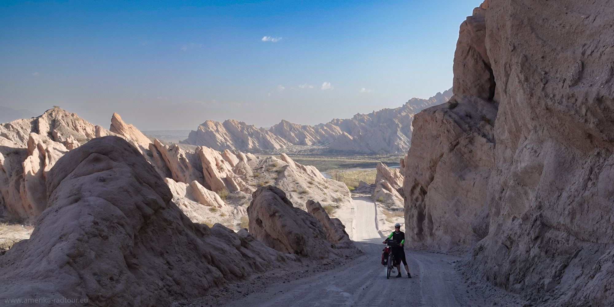
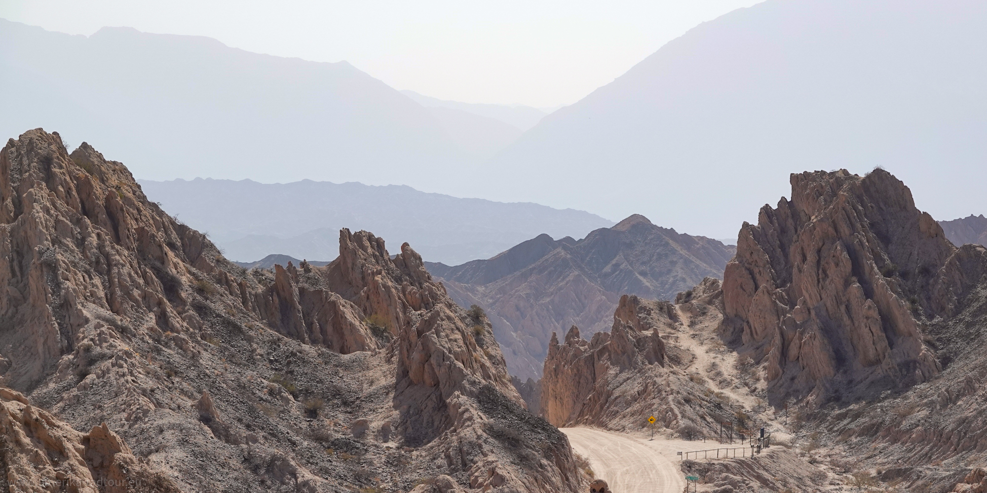
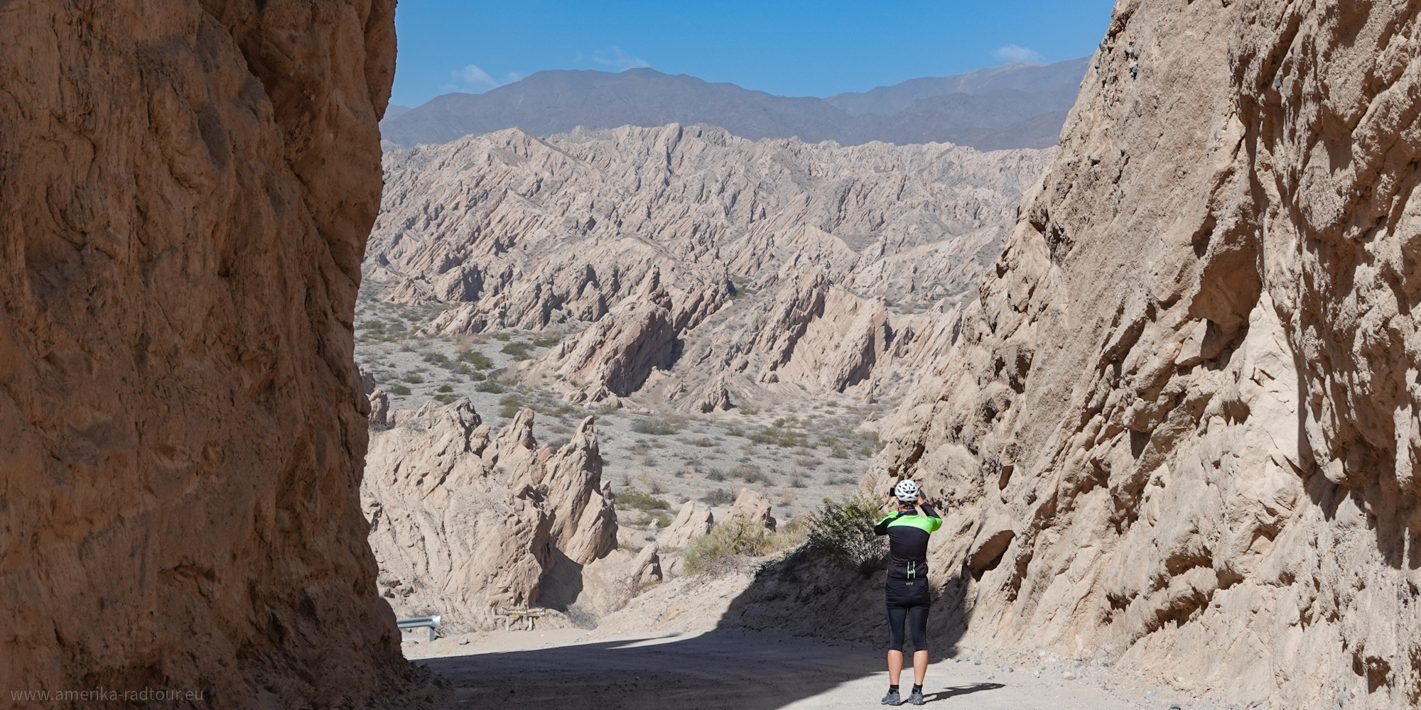 The second ascent leads through narrow rock faces up to the Flechas Pass and offers spectacular views over the landscape marked by steeply rising rock layers. This unique landscape was created around 15 to 20 million years ago, when the rocky ground on the edge of what is now Puna started to rise. What remains are the rock slabs that protrude steeply from the ground, up to 20 m high, protruding from the ground like teeth. The second ascent leads through narrow rock faces up to the Flechas Pass and offers spectacular views over the landscape marked by steeply rising rock layers. This unique landscape was created around 15 to 20 million years ago, when the rocky ground on the edge of what is now Puna started to rise. What remains are the rock slabs that protrude steeply from the ground, up to 20 m high, protruding from the ground like teeth. |
 In addition to the impressive rock formation, the incredible tranquility surrounding these rocks is striking. We are the only people moving in this lunar landscape and this silence makes the landscape seem even more impressive. In addition to the impressive rock formation, the incredible tranquility surrounding these rocks is striking. We are the only people moving in this lunar landscape and this silence makes the landscape seem even more impressive. |
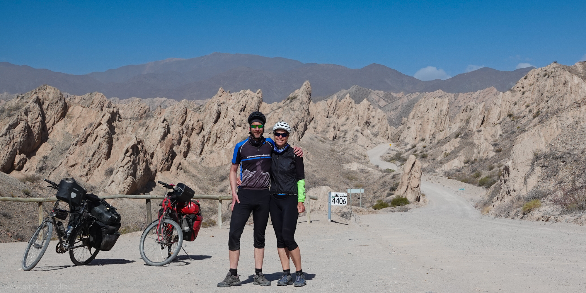 At kilometer 4406 there is a small car park from which a short path leads all the way up to a place called Mirador Ventisquero. The path is short and steep, but it is worth the effort: the view from above gives a hint of the dimensions of this peculiar landscape. At kilometer 4406 there is a small car park from which a short path leads all the way up to a place called Mirador Ventisquero. The path is short and steep, but it is worth the effort: the view from above gives a hint of the dimensions of this peculiar landscape. |
 On the east side of the pass, the route descends steeply for about 100 m; here too, Ruta 40 is marked by rocky peaks jutting out of the ground. The track is not any easier to ride than yesterday's section, but the spectacular scenery makes up for all the effort. On the east side of the pass, the route descends steeply for about 100 m; here too, Ruta 40 is marked by rocky peaks jutting out of the ground. The track is not any easier to ride than yesterday's section, but the spectacular scenery makes up for all the effort. |
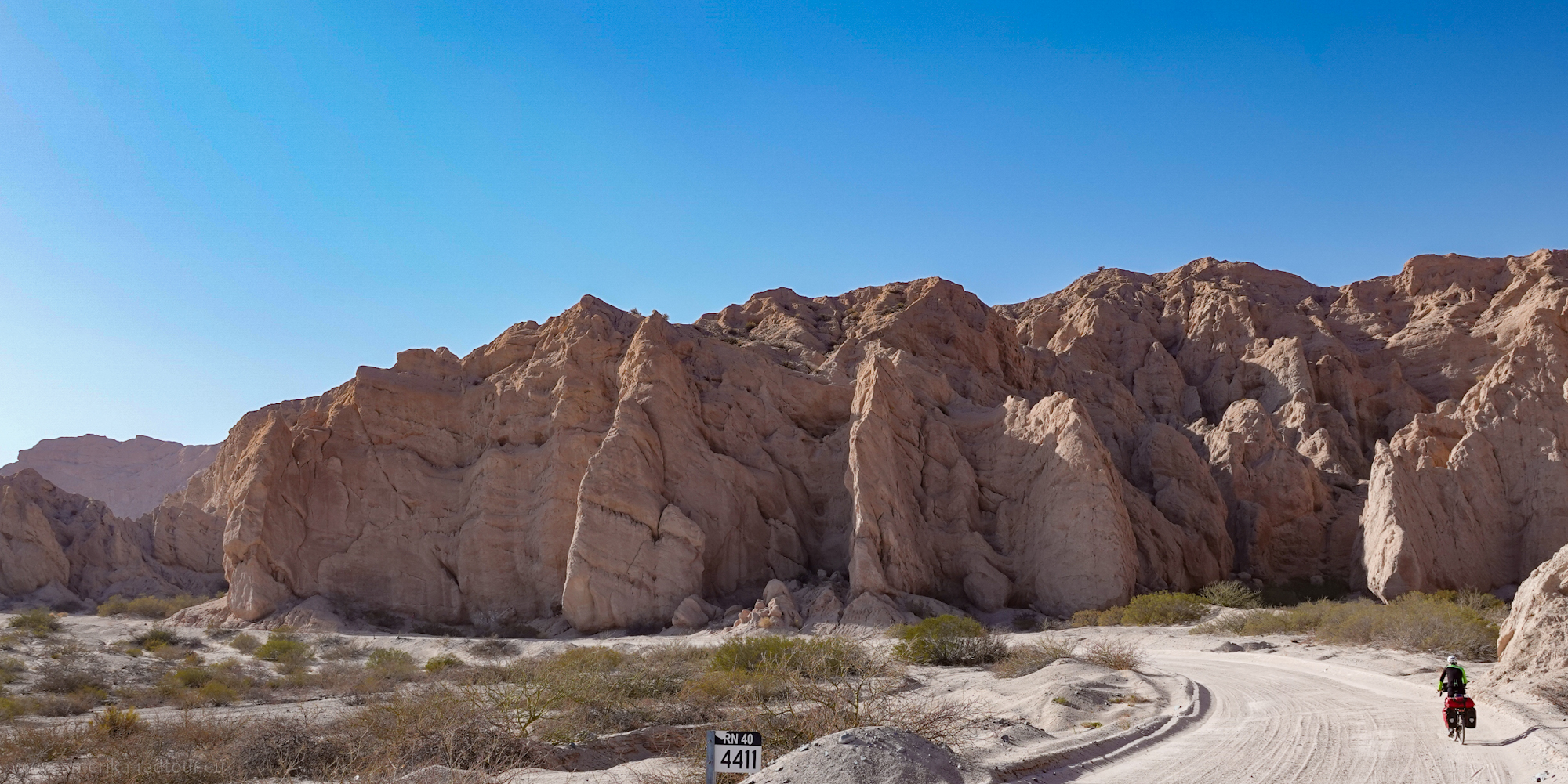
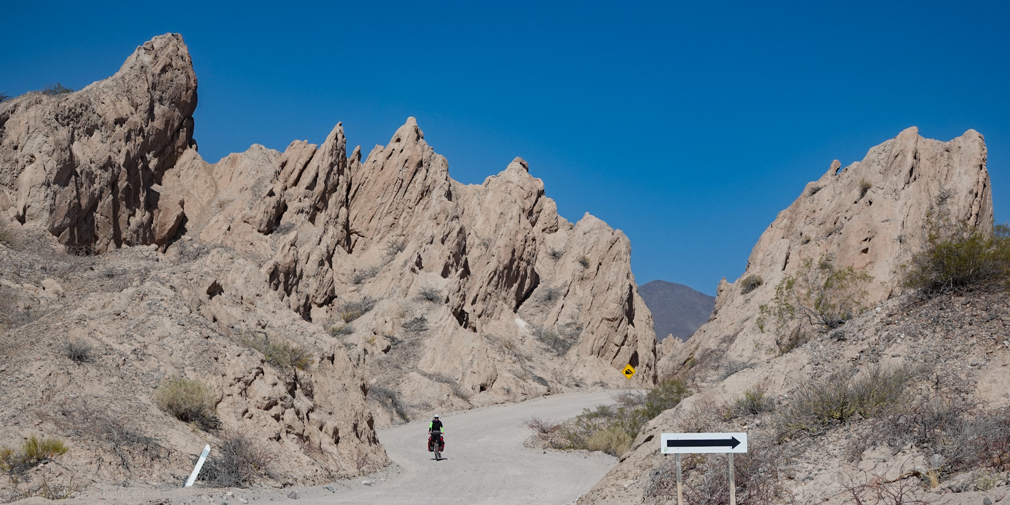
 In some areas, the rock peaks have been so worn down and rounded by erosion making them look like termite mounds, although termite mounds rarely stand at an angle. In some areas, the rock peaks have been so worn down and rounded by erosion making them look like termite mounds, although termite mounds rarely stand at an angle. |
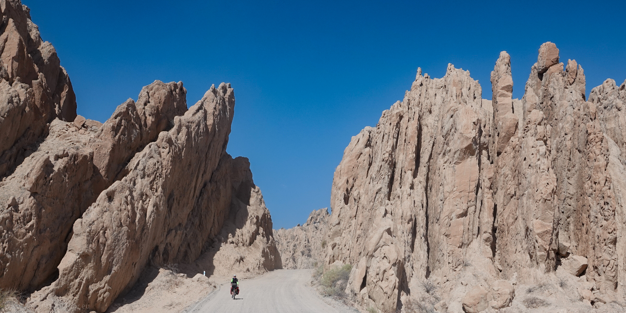 Because of the inclination of the rock slabs, the top of some of the rocks is about 18 m above our heads. But anything that has been standing around in the landscape undamaged for 15 million years will probably last long enough to be still standing around today. Because of the inclination of the rock slabs, the top of some of the rocks is about 18 m above our heads. But anything that has been standing around in the landscape undamaged for 15 million years will probably last long enough to be still standing around today. |
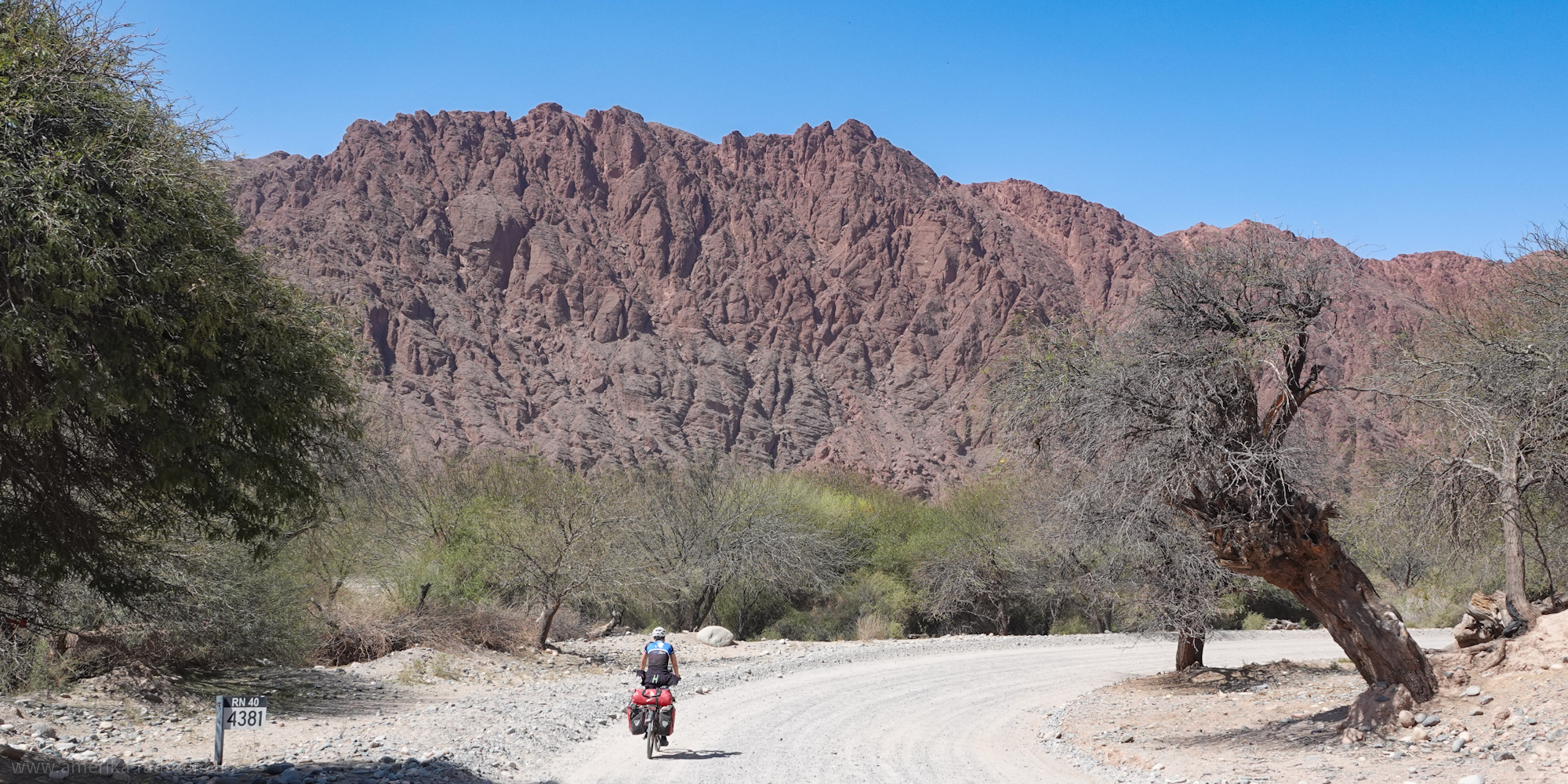 After about 10 kilometers / 6 miles we leave the Quebrada de las Flechas and the landscape changes both topologically and in terms of color. The rocks now have a reddish hue again. After about 10 kilometers / 6 miles we leave the Quebrada de las Flechas and the landscape changes both topologically and in terms of color. The rocks now have a reddish hue again. |
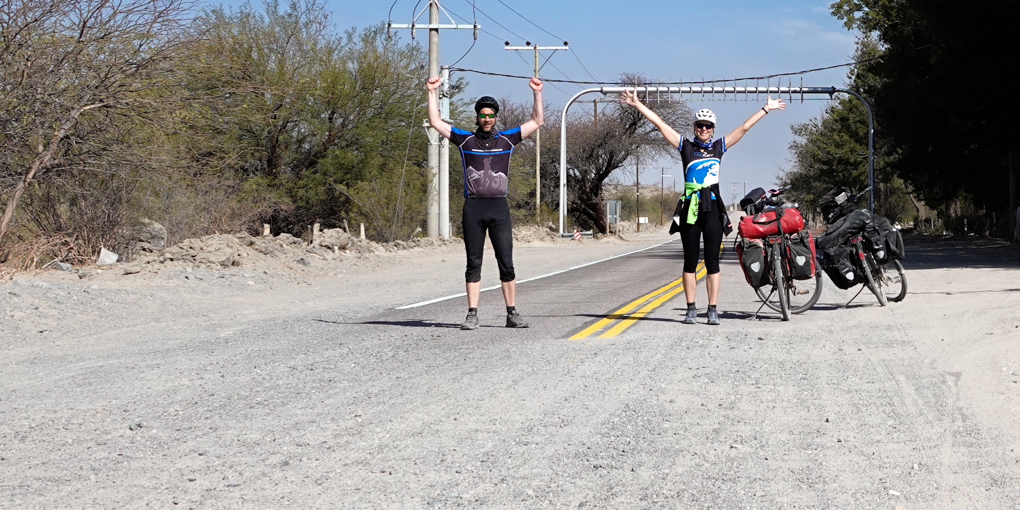 Shortly before San Carlos there is another highlight: we reach the start of the asphalt road! From Susques via San Antonio de los Cobres and Cachi to here, Ruta 40 has shown its unpleasant side with corrugated iron, gravel and sand. From now on it is all asphalt and we are amazed at how easily and quickly the bikes can move on the flat asphalt road. Shortly before San Carlos there is another highlight: we reach the start of the asphalt road! From Susques via San Antonio de los Cobres and Cachi to here, Ruta 40 has shown its unpleasant side with corrugated iron, gravel and sand. From now on it is all asphalt and we are amazed at how easily and quickly the bikes can move on the flat asphalt road. |
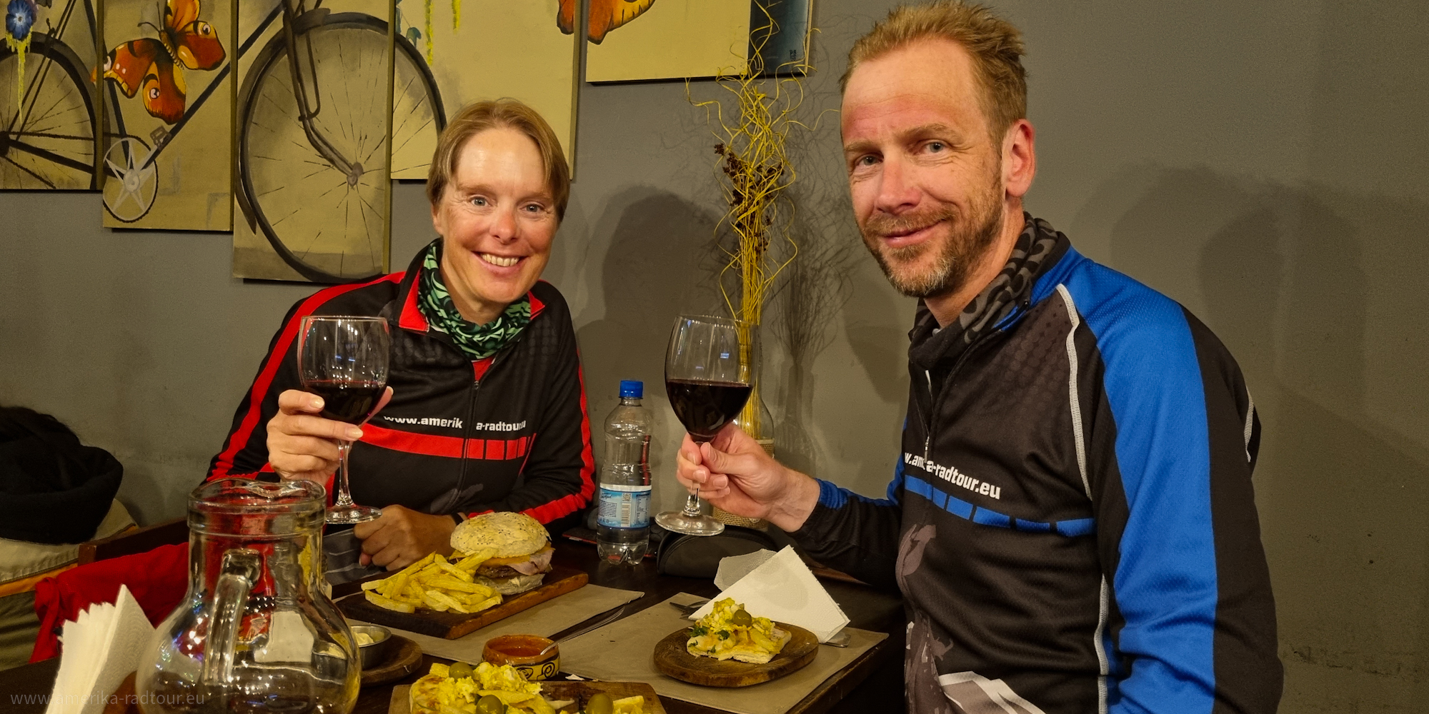 In the late afternoon we reach San Carlos, which has just over 2,000 inhabitants and offers travellers a wide range of accommodation and restaurants. In what is now the town of San Carlos, the Spanish built a settlement four times between 1551 and 1630, all of which were destroyed by fighters from the indigenous Calchaqui population. At some point later in history there were attempts to make San Carlos the provincial capital of Salta, but they were unable to prevail against the city of Salta. In San Carlos we celebrate our arrival on the paved road. Even if the dusty track of the last few days might not suggest it, we are in the middle of one of Argentina's most famous wine regions. In the late afternoon we reach San Carlos, which has just over 2,000 inhabitants and offers travellers a wide range of accommodation and restaurants. In what is now the town of San Carlos, the Spanish built a settlement four times between 1551 and 1630, all of which were destroyed by fighters from the indigenous Calchaqui population. At some point later in history there were attempts to make San Carlos the provincial capital of Salta, but they were unable to prevail against the city of Salta. In San Carlos we celebrate our arrival on the paved road. Even if the dusty track of the last few days might not suggest it, we are in the middle of one of Argentina's most famous wine regions. |