")

- Vancouver - SanFrancisco
{mosmap kml='http://amerika-radtour.eu/gps/2013.kml' | zoom='4' | showmaptype='1' | showscale='1' | ZoomType='Small' | width='100%' | height=240px' | centerlat='42.5' |centerlon='-105.0'| maptype='Terrain' }
 |
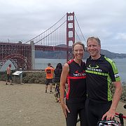
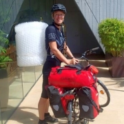
Etappe 2013/01 [A001] | ||
| Vancouver - Blaine - Bellingham | |||
| 106 km | |||
| 685 Hm (garmin etrex) | |||
 |
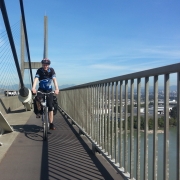
Etappe 2013/02 [A002] | ||
| Bellingham - Chuckanut Drive - Deception Pass Bridge - Port Townsend | |||
| 118 km | |||
| 1066 Hm (garmin etrex) | |||
 |
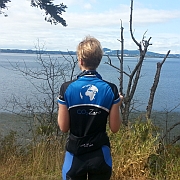
Etappe 2013/03 [A003] | ||
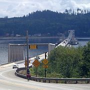
| Port Townsend - Port Hadlock - Port Ludlow - Hood Canal Floating Bridge - Silverdale - Bremerton | |||
| 79 km | |||
| 834 Hm (garmin etrex) | |||
 |
Etappe 2013/04 [A004] | ||
| Bremerton - Belfair - Shelton - Elma | |||
| 107 km | |||
| 746 Hm (garmin etrex) | |||
 |
Etappe 2013/05 [A005] | ||
| Elma - Oakville - Rochester - Toledo - Castle Rock | |||
| 119 km | |||
| 466 Hm (garmin etrex) | |||
 |
Etappe 2013/06 [A006] | ||
| Castle Rock - Cathlamet - Westport - Astoria | |||
| 108 km | |||
| 1070 Hm (garmin etrex) | |||
 |
Etappe 2013/07 [A007] | ||
| Astoria - Cannon Beach - Arch Cape - Wheeler - Tillamook | |||
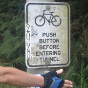
| 111 km | |||
| 1052 Hm (garmin etrex) | |||
 |
Etappe 2013/08 [A008] | ||
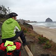
| Tillamook - Oretown - Neskowin - Lincoln City | |||
| 80 km | |||
| 949 Hm (garmin etrex) | |||
 |
Etappe 2013/09 [A009] | ||
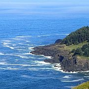
| Lincoln City - Newport - Yachats - Washburne State Park (Oregon Coast Highway) | |||
| 104 km | |||
| 901 Hm (garmin etrex) | |||
 |
Etappe 2013/10 [A010] | ||
| Washburne State Park - Reedsport - Lakeside - North Bend | |||
| 98 km | |||
| 858 Hm (garmin etrex) | |||
 |
Etappe 2013/11 [A011] | ||
| North Bend - Charleston - Sixes - Port Orford - Ophir | |||
| 129 km | |||
| 1212 Hm (garmin etrex) | |||
 |
Etappe 2013/12 [A012] | ||
| Ophir - Gold Beach - Fort Dick - Crescent City | |||
| 107 km | |||
| 823 Hm (garmin etrex) | |||
 |
Etappe 2013/13 [A013] | ||
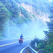
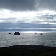
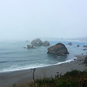
| Crescent City - Klamath - Newton B. Drury Scenic Parkway - Orick - Patricks Point State Park (Redwood Highway). | |||
| 91 km | |||
| 1177 Hm (garmin etrex) | |||
 |
Etappe 2013/14 [A014] | ||
| Patricks Point - Arcata - Eureka - Fields Landing - Loleta - Ferndale (Redwood Highway, Mattole Road) | |||
| 87 km | |||
| 489 Hm (garmin etrex) | |||
 |
Etappe 2013/15 [A015] | ||
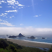
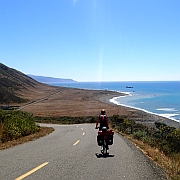
| Ferndale - Cape Town - Lost Coast - Petrolia (Mattole Road) | |||
| 58 km | |||
| 1392 Hm (garmin etrex) | |||
|
Etappe 2013/16 [A016] | ||
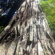
| Petrolia - Mattole Road - Bull Creek Flats Road - Avenue of the Giants - Myers Flat | |||
| 63 km | |||
| 1047 Hm (garmin etrex) | |||
 |
Etappe 2013/17 [A017] | ||
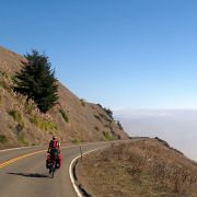
| Myers Flat - Miranda - Phillipsville - Garberville - Benbow - Piercy - Leggett - Rockport - Hardy - Westport (Avanue of the Giants, Redwood Highway, Shoreline Highway) | |||
| 112 km | |||
| 1557 Hm (garmin etrex) | |||
 |
Etappe 2013/18 [A018] | ||
| Westport - Inglenook - Fort Bragg - Mendocino - Point Arena | |||
| 102 km | |||
| 1059 Hm (garmin etrex) | |||
 |
Etappe 2013/19 [A019] | ||
| Point Arena - Anchor Bay - Gualala - Timber Cove - Fort Ross - Bodega Bay (Coast Highway) | |||
| 104 km | |||
| 1407 Hm (garmin etrex) | |||
 |
Etappe 2013/20 [A020] | ||
| Bodega Bay - Valley Ford - Tomales - Nicks Cove - Marshall - Marconi - Millerton - Bivalve - Point Reyes - Tocaloma - Samuel P. Taylor State Park | |||
| 67 km | |||
| 818 Hm (garmin etrex) | |||