


")

 |
Stage 2019/08 [A070] | ||
|
Rest Area km88 - Little Gold Creek - Poker Creek - Chicken (Top of the World Highway Highway, Taylor Highway) |
|||
| 54 mi / 87 km | |||
| 1300 Hm (garmin edge 1000) | |||
Cycling Whitehorse, Yukon to Anchorage, Alaska via Dawson City.Stage from Dawson City to Chicken following the Top Of The World Highway part 2/2.One of the most epic cycling routes of the world. |
 The night in the tent was quite comforting, we were not disturbed by any wild animal - which does not mean that there was no animal. They kindly let us sleep. Despite the protected location of our camp site, it was quite cold and windy at night, even in summer temperatures around freezing are not uncommon here. Anyone who cycles along Top of the World Highway should not only bring sufficient food supply but also suitable equipment. The cold wind makes us leave early, the rest of the stage on the Top of the World Highway is waiting for us. |
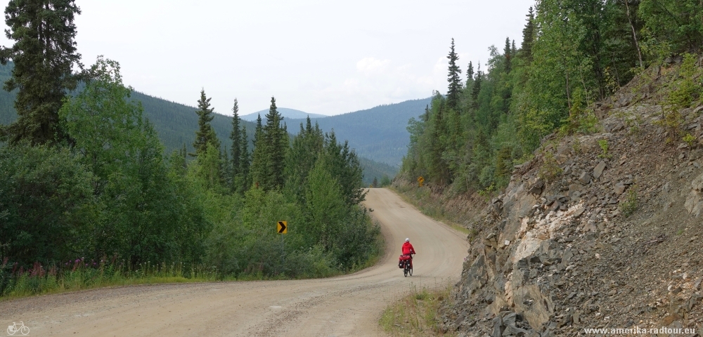
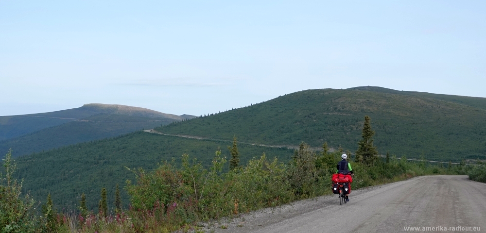 Apart from a few short but crisp climbs, the Top of the World Highway is pleasant to cycle on. Despite the fact that this part of the highway is not paved, the road is in good condition. And you can't get lost, the kilometers ahead of us can be seen clearly in advance. |
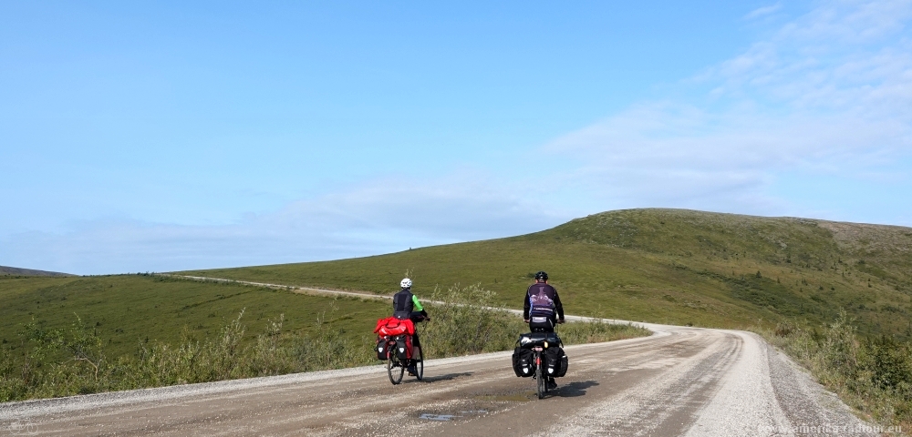 In time, even the sun means well with us, the sky opens up in sections and we cycle under a blue sky. Today, on early august, we are lucky that the highway is not showing its unpleasant side as a result of days of constant rain. Since the Top of the World Highway is usually closed when the first snowfall occurs and only opens again in the spring, the road quality is slightly different every year. |
 The Top of the World Highway is neither a highway nor is it 'top of the world'. The surface is not paved, but as of 2019 in good condition. In the past, when the Clinton Creek asbestos mine was still in operation, part of the highway was accessible even in winter. Today the route is only open in summer, and the border crossing between Canada and Alaska / USA is only open from May to September. |
 On the Canadian section of the Top of the World Highway, a small memorial has been erected on the highway at km 100: a wooden panel commemorates the construction period. There are sources on the Internet that promise a toilet house and bear-safe trash cans here, but as of 2019 there was nothing of that. In retrospect, our decision to set up our tent at kilometer 88 was not that wrong. I guess, the highway administration does not want to make this place overly comfortable, otherwise too many people would fill tihs place over night. |
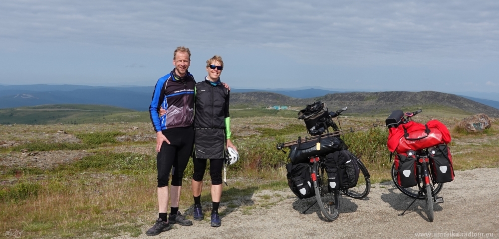
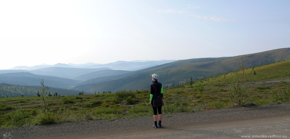 The entire highway offers incredibly wide views over the Yukon. The country seems endless, we feel the loneliness. It is not without good reason that the Top of the World Highway is known to cyclists as one of the most epic cycling routes in the world. By the way, it is also nice to meet oncoming cyclists here: there is always time for a chat on the roadside, there is hardly any more up-to-date information than first-hand reports from other cyclist. I am always surprised how many fine people are out there cycling. |
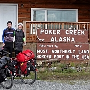
 At kilometer 106 / mile 66 (counted from Dawson City, about 11mi / 18km from our campground) we arrive at the border post to Alaska. Coming from Canada, the Poker Creek border post is behind a last climb. This climb leads to the highest point of the Top of the World Highway (at about 4365ft / 1330m) and offers a view of the border installation, which actually consists of a handful of houses, two flagpoles and a gate. |
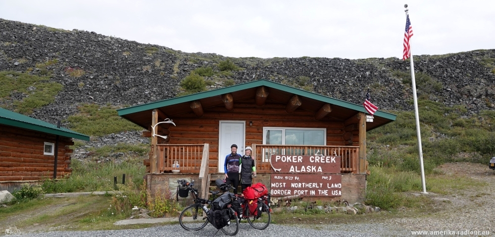 The border post at Poker Creek is the second highest border crossing between Canada and the United States and the northernmost border post on the American mainland. The population of Poker Creek is subject to fluctuations of up to 50% as sometimes 2 or 3 American border guards live here, depending on the season. Even if the Canadian and US border posts are only a few meters apart, there is a time difference of one hour between them since CAnada and the US are in different time zones. And we experienced another weird detail in the American border barrack: it is the first time that we have to pay entrance fee when entering the USA. After scanning the fingerprints, we have to pay 6 USD per head and because there are problems with the credit card device, we have to pay in cash. |
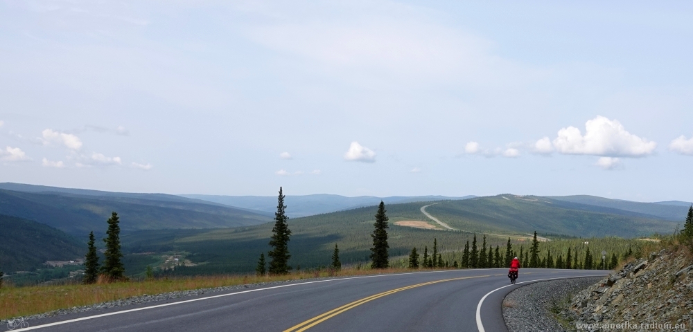 On the Alaskan section the Top of the World Highway is paved. Not only that: I have never seen a better asphalt road anywhere in the USA than up here west of Poker Creek. The first kilometers from Poker Creek to Boundary, an abandoned village from the gold rush era (the restaurant formerly run by the only resident burned down a few years ago), are downhill. |
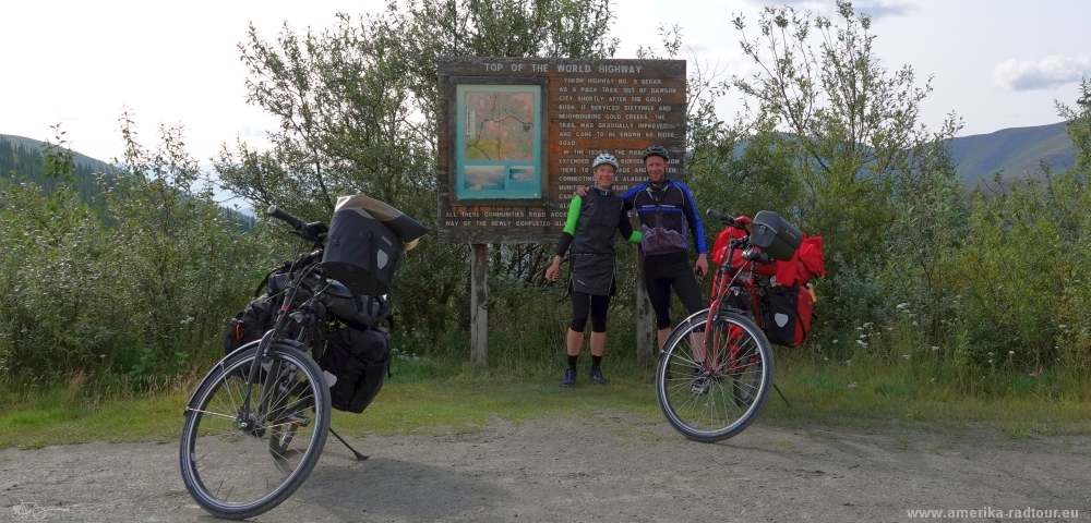
 The Top of the World Highway ends shortly before Jack Wade Junction where it joins Taylor Highway, which connects the village of Eagle further north with the Alaska Highway. The asphalt surface ends shortly before this junction, from here we cycle on gravel again. Jack Wade, named after Jack Anderson and Wade Nelson, who operated a gold mine here in 1930, has not had a single inhabitant for a long time, the former settlement only appears in the name of the intersection of the Taylor Highway and marks the end point of the Top of the World Highways. |
 Likethe Top of the World Highway, Taylor Highway is not paved, but it is in a much worse condition. The fact that we drive this part downhill only makes it worse because the loose gravel makes cycling a more dangerous. |
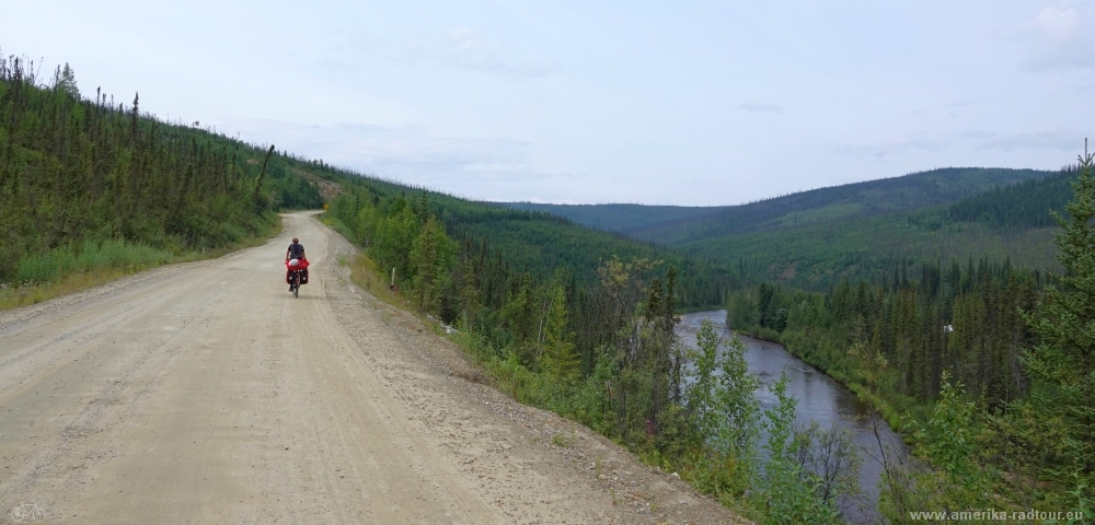 Between Jack Wade Junction and Chicken the Taylor Highway follows the Walker Fork river. Unfair: While the Walker Fork meanders down there in the valley and flows in tight loops through the landscape, we have to cycle uphill on the slope south of the river before we can finally roll downhill to Chicken. |
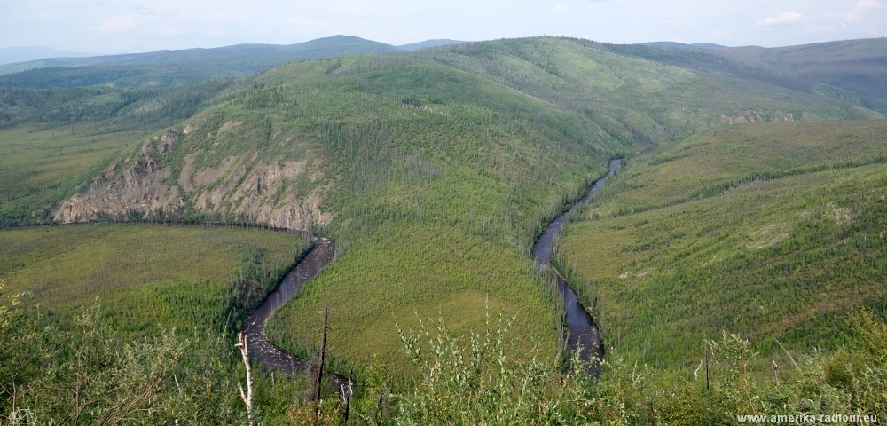 At the highest point of the short climb at an altitude of about 750m there is a beautiful view of the course of the Walker Fork. |
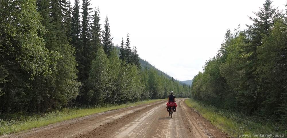 The further course of the Taylor Highway is such that I don't want to drive it in the pouring rain. In total we drove 1300 meters uphill and 1800 meters downhill today. But the downhill sections are the most demanding due to the nature of the road. |
 The Chicken Gold Camp campsite has usable showers but you should bring a sack of coins for hot water. I would like to note that the Taylor Highway with its surface made of loose gravel can be dangerous for cyclists, especially cycling downhill is not free of risk. |